The Best Hunting App for 2026, by Hunter Type
“Best hunting app” depends on what you hunt and how. This compares four leaders — onX Hunt, HuntStand, Spartan Forge, and Contors (occasionally typed “Contours app”) — on each company’s own published pricing and features as of August 2026. Contors builds one of the four; the facts below are sourced from each company’s materials, and the verdicts say plainly who each app is for.
| Contors | onX Hunt | HuntStand | Spartan Forge | |
|---|---|---|---|---|
| Focus | Purpose-built for whitetail — 100% of the product aimed at the deer you actually hunt | Generalist — all species across all 50 states, with deep public-land tools | Generalist — hunting plus land management, whitetail to Western big game | Deer-focused mapping built around LiDAR and UAV imagery |
| Pricing | Free plan (no card) · Pro $4.99/mo or $39.99/yr · Unlimited $9.99/mo or $79.99/yr | Free basic · Premium $34.99/yr covers one state · $49.99/yr two states · Elite $99.99/yr or $14.99/mo for all states + Canada | Free tier · Pro from $34.99/yr · Ultimate $99.99/yr for the advanced whitetail tools | Free version · Paid $79.99/yr or $12.99/mo, one tier |
| Free trial | 7 days — free trial on Pro and Unlimited | 7 days | No stated trial; free tier available | Varies; free version available |
| State coverage | Every state included on every plan | Per-state on Premium; all 50 + Canada requires Elite ($99.99/yr) | All 50 states + most of Canada on paid plans | All states, one price |
| Satellite & base maps | Three satellite providers in one app — Google, Esri, and USDA NAIP aerial — plus full USGS topo; switch per hunt | Proprietary basemaps with satellite, topo and hybrid views; Elite adds recent + leaf-off imagery | National aerial imagery with monthly satellite updates on paid plans | UAV imagery where covered, satellite elsewhere |
| Lidar / terrain shading | USGS 3DEP lidar shading on both paid plans — layers over topo and satellite; USGS topo and contour lines are on every tier, free included | Elite adds TerrainX terrain analysis | 3D mapping on paid plans | Proprietary LiDAR layer — 1m resolution for roughly two-thirds of the lower 48, on the paid plan |
| Property lines & owners | All 50 states with full parcel detail — owner name & contact info — on BOTH paid plans. Pro and Unlimited get identical parcel data, from $39.99/yr; boundary lines are on the free plan too | Landowner information on paid plans — but coverage follows the per-state tiering: one state at $34.99/yr, two states at $49.99/yr, and all 50 states requires Elite at $99.99/yr | All 50 states with ownership data and owner search on paid plans — genuinely nationwide, like Contors | Private and public land boundaries on paid plan; basic ownership on free |
| AI assistant | Scout acts, not just answers — drops pins, draws routes, plans hunts, grades wind on your terrain, and shows its work | Not advertised | Not advertised | CyberScout assistant (question-and-answer style) |
| AI stand rating | AI stand rating — every stand graded live against wind, thermals and your bedding | Not advertised | Not advertised | Not advertised |
| AI terrain analysis | AI terrain analysis reads your ground for draws, saddles and benches | TerrainX terrain tools on Elite | 3D terrain fly-through | LiDAR and slope layers for manual terrain reading |
| Buck tracking & trophy room | Buck Tracker & Trophy Room — hit-list profiles with AI age & score from trail-cam photos, sightings linked to your journal | Trail Cam Analysis on Elite | Trail-camera photo tools | Not advertised |
| Deer prediction / analysis | Buck Refuge Model — a bedding-security heat map computed from your own boundary, cover and pressure | Not advertised | 15-day activity forecasts and rut maps — on the $99.99 Ultimate tier | AI deer-movement prediction model |
| Weather | 16-day forecast with wind, thermals and deer-movement conditions | Wind and weather layers on paid plans | Detailed weather forecasts | Weather and lunar data |
| In-app support | Two taps to a monitored inbox — feedback and support built into the app, read by the builder | Help center and support channels | Help center and support channels | Help center and support channels |
| Referral program | Refer a buddy — you both earn a free month | Not advertised | Not advertised | Not advertised |
| Offline maps | Offline map areas — maps, pins and routes with zero signal | Unlimited offline maps on paid plans | Unlimited offline maps on paid plans | Offline maps on paid plan |
| Platforms | iOS app + full web/desktop | iOS, Android, web | iOS, Android, web | iOS, Android, desktop |
Which app for which hunter
Whitetail hunters: Contors. It is the only app here built exclusively for whitetail — Scout works your map (pins, routes, hunt plans, wind calls), the Buck Refuge Model grades your own ground, all 50 states of parcel data — owner names and contact details — come with both paid plans from $39.99/yr, and the 7-day trial lets you test it on your own ground first.
Multi-state and public-land hunters: onX Hunt — public-land data, hunting units and draw research, with all-state coverage on the $99.99 Elite tier.
Landowners and lease managers: HuntStand — property lines with owner search, monthly satellite updates, land-management tools, and a usable free tier.
Terrain-first hunters: Spartan Forge — the LiDAR layer is its calling card, with an AI movement model on top at a single $79.99/yr price.
Worth weighing across the table: Contors is the only app on this page whose published materials include lidar terrain shading over both topo and satellite, three satellite providers in one app, an AI stand-rating system, a buck tracker with AI aging and scoring, and a referral program — while onX’s Trail Cam Analysis and TerrainX (on Elite) and Spartan Forge’s LiDAR layer are their own genuine strengths in those rows.
What to check before you pay for any hunting map app
Whether your state is included at the price shown (per-state pricing adds up fast), which tier actually holds the property-line and owner data, whether offline maps are gated higher, how long the trial really is, and whether the “AI” changes your plan or just chats beside the map. Run your actual property through the trials — Contors gives you 7 days to do exactly that.
Try Contors Free — 7 Days Free trial on both paid plans · free plan needs no card
Maps and data, side by side
Three satellite basemaps, two topos, lidar shading over either one, and the same county-record parcel data the big apps use — on a $39.99/yr plan.
| Maps & data | ContorsPro $39.99/yr | onX HuntElite $99.99/yr |
|---|---|---|
| Satellite basemaps | 3 — Google, Esri, USDA NAIP aerial | 1 |
| Topo basemaps | 2 — USGS Topo, Esri Outdoor | 1 — plus a Hybrid view that adds contours to satellite |
| Lidar shading over satellite | Yes — it's the default view | No — the Lidar toggle lives on the Topo basemap |
| Lidar shading over topo | Yes | Yes, on Elite |
| Lidar is included from | Pro, $39.99/yr, all 50 states | Elite, $99.99/yr |
| Parcel lines & owner names | All 50 states on Pro and Unlimited — county records via Regrid | One state on Premium ($34.99/yr); all 50 on Elite ($99.99/yr) |
| Offline maps | Pro: one saved area · Unlimited: as many as you want | Paid plans; lidar offline on Elite |
| AI that has read your map | Scout — knows your stands, boundaries, journal and today's conditions | Not advertised |
| Built for | Whitetail, and nothing else | Every species, every state |
Contors figures come from the app. onX figures come from onX's basemap guide, its Lidar support article and its pricing page, checked September 2026. onX® and onX Hunt® are trademarks of onXmaps, Inc.
onX® and onX Hunt® are trademarks of onXmaps, Inc. HuntStand® is a trademark of TerraStride Inc. Spartan Forge® is a trademark of Spartan Forge. Contors is not affiliated with, endorsed by, or sponsored by any of these companies. Competitor information reflects each company’s own published materials as of August 2026; features and prices change — verify current details on their websites. “Not advertised” means we did not find the feature in the company’s published materials, not that it does not exist.
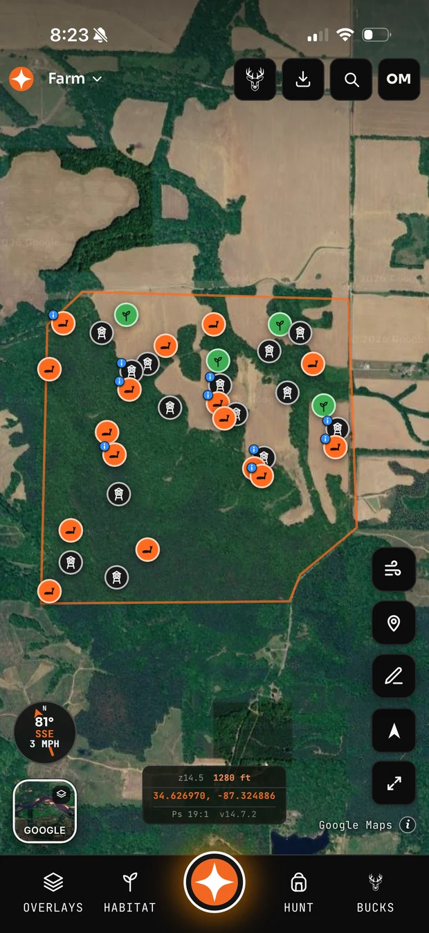
What Contors looks like