See Where Your Scent Actually Goes

Contors models the air on your ground, not the wind at the airport. A weather station tells you it is 8 mph out of the southeast. That is not what the air does in your creek bottom at last light. Contors takes the forecast wind and solves it over the terrain of your property, then shows you where your scent actually travels from any stand.
The scent plume
Turn scent on and every stand shows where its scent goes — not a fixed cone drawn at wind-plus-180, but a plume that follows the modelled air: bending into a draw, running the ridge, spreading where the air is unsettled.
- Every stand on the property at once, so you can see which ones are clean and which are not
- Your own position, when location is on — the plume follows you as you walk in
- The track you are recording, so you can see the scent you laid on the way to the stand
- Any route you tap, as a continuous sheet off the whole line
It runs as a time-lapse, so a few seconds of watching shows several minutes of drift.
Thermals
In hill country the thermal beats the prevailing wind at dawn and dusk. Cold air falls downhill in the morning and rises as the ground warms in the evening, and on the wrong slope that reverses everything the forecast told you.
Contors classifies the air on your ground into wind-driven, thermal, and the mixed and transition states between them, and the plume follows whichever is actually in charge at that hour. Where the air is barely moving, the plume shows it creeping and spreading instead of running — which is the most dangerous state to sit in, and the one a compass rose cannot tell you about.
Stands ranked for the wind
Every stand carries its best winds. Pick a date and an hour and each stand is scored against that hour’s forecast wind, with the top pick flagged — and the scent geometry to your bedding areas is part of the score, not an afterthought.
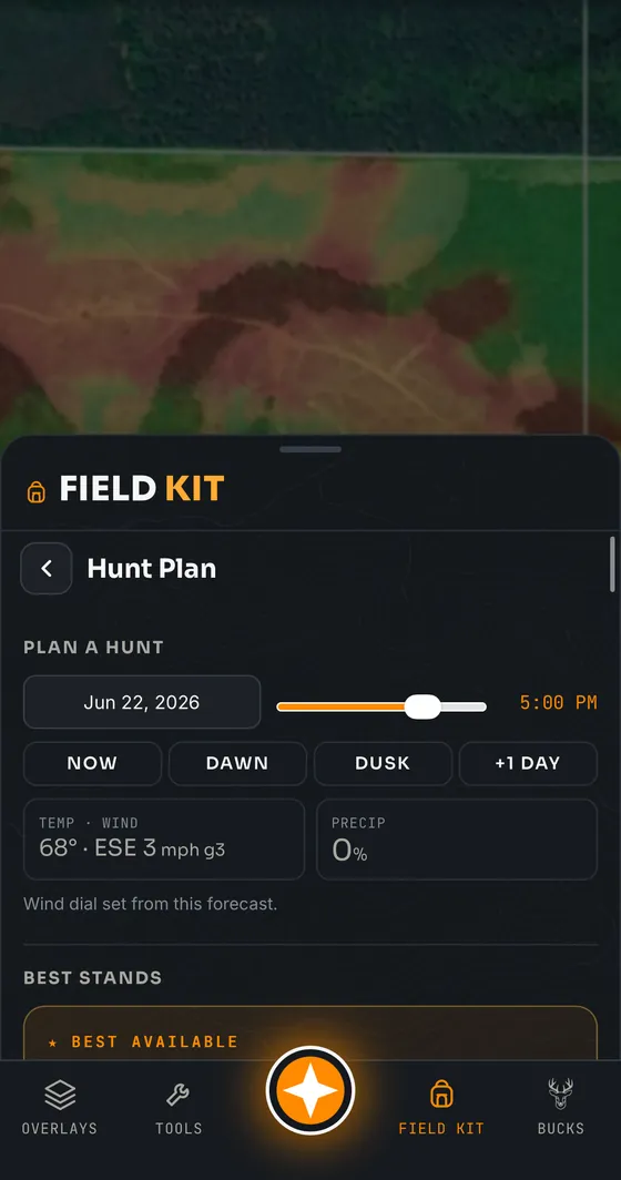
Ask Scout the same question in words and it will name the stand and tell you why.
Honest about its limits
This is a model, not a measurement. It says so on the map when the field is uncalibrated for your area, when the air is too still to claim a direction, and when a plume runs past the edge of the loaded data. A tool that pretends to certainty about wind is worse than no tool.
Common questions
Does Contors show a scent cone?
It shows more than a cone. Contors solves the forecast wind over your property’s terrain and draws a scent plume that follows the actual modelled airflow, so it bends into draws and follows ridges rather than running in a straight line from the stand.
Does Contors handle thermals?
Yes. It classifies the air on your ground as wind-driven, thermal or mixed, and the plume follows whichever is dominant at that hour — falling downhill in the morning and rising in the evening where the terrain and conditions call for it.
Can it tell me which stand to hunt on a given wind?
Yes. Every stand is scored and ranked for a chosen date and hour against that hour’s forecast wind, including the scent geometry to your bedding areas, with the best one flagged. Scout will answer the same question conversationally.
Is the wind and scent tool available on the free plan?
The wind, scent and live weather tools are part of every plan, free included.
Related: all features · thermals explained · using wind direction · Scout AI