A Heat Map of Where a Mature Buck Feels Safe
The Buck Refuge Model grades your ground for refuge quality — how good each acre is for a mature buck to bed and feel secure. Green is prime, yellow is middling, red is poor. It is built from your property, so it changes when you add an ATV trail, a new stand, or a food plot.
What earns green
A spot earns green by stacking several things at once, not by any one of them:
- Bedding cover — thickness, from your habitat areas and the imagery
- Distance from human pressure — roads, trails, parking, access routes and structures, each fading with distance rather than stopping at a line
- Travel distance off food — a band that widens through the rut
- Water nearby
- Terrain — the shape of the ground from lidar-derived elevation
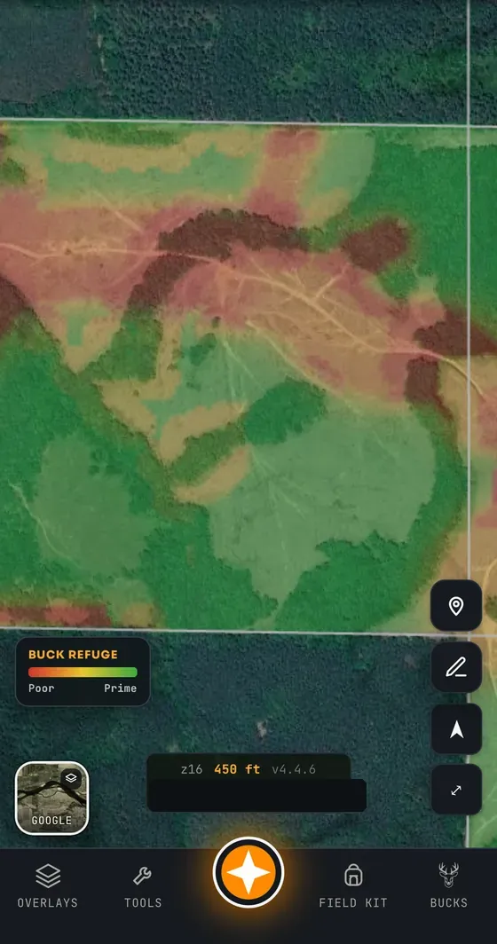
The more of your property you map — especially your access, your trails and your food — the sharper it gets. On a property with only a boundary drawn, it will say so.
The part hunters miss
Pressure is the input most people underestimate. Your own ATV trail, your parking spot and your walk-in route are pressure, and they cost you refuge on ground you thought was untouched. Map your access honestly and the model shows you what your own hunting is doing to the property.
It is also why the model is worth re-reading after you change something. Move parking 200 yards and the interior grades differently.
What it is not
It is not a prediction of where a specific deer is. It grades habitat quality for security, from data you supplied. It cannot see the neighbour’s pressure unless you map what you know of it, and it does not claim to.
Common questions
What is the Buck Refuge Model?
It is a heat map in Contors that grades every part of a property for refuge quality — how suitable it is for a mature buck to bed and feel safe. It combines bedding cover, distance from human pressure such as roads, trails, parking and structures, travel distance off food, water and terrain shape, and renders the result green through red.
Does it tell me where the deer are?
No. It grades habitat for security using the data you have mapped. It does not track or predict individual animals, and it is only as good as the property information you give it.
Does my own access hurt the score?
Yes, and that is the point. Your ATV trails, parking and walk-in routes count as human pressure and reduce refuge quality nearby, fading with distance. Mapping your access honestly shows what your own hunting costs you.
Which plan includes the Buck Refuge Model?
It is included with Pro and Unlimited.
Related: all features · hunting pressure and mature bucks · where mature bucks bed