Three Satellites, Two Topos, and LiDAR Over Any of Them

Contors gives you five basemaps and lets you lay USGS lidar shading over any of them. Most hunting apps give you one satellite layer and one topo, and lock lidar to the topo. Here you can put bare-earth relief over Google satellite and see the bench and the cover at the same time.
The basemaps
- Google satellite — the sharpest, most current look at your cover
- Esri satellite — a second source, often flown in a different season
- USDA NAIP aerial — national agricultural imagery, free on every plan
- USGS Topo — the classic quad sheet
- Esri Outdoor topo — a cleaner modern topo
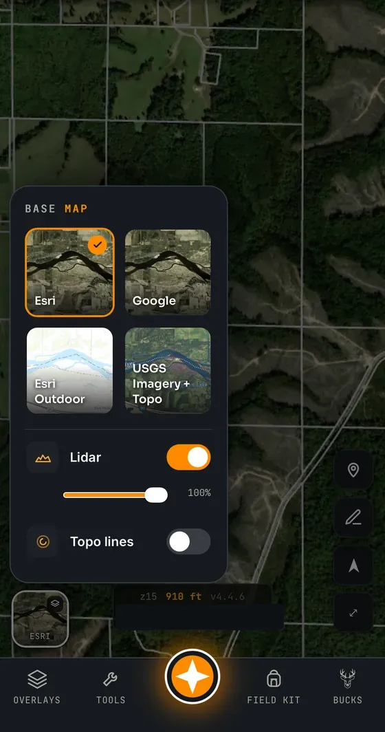
Two of the five — NAIP aerial and USGS topo — are on the free plan, along with contour lines, so a free account is a genuinely usable map.
LiDAR shading, over whatever you like
The lidar layer is USGS 3DEP elevation rendered as hillshade. It shows the shape of the ground under the canopy: benches, saddles, ditches, old roadbeds, terraces, and the subtle points bucks actually walk. In Contors it is a shading layer, not a basemap, so it goes over satellite as happily as over topo.
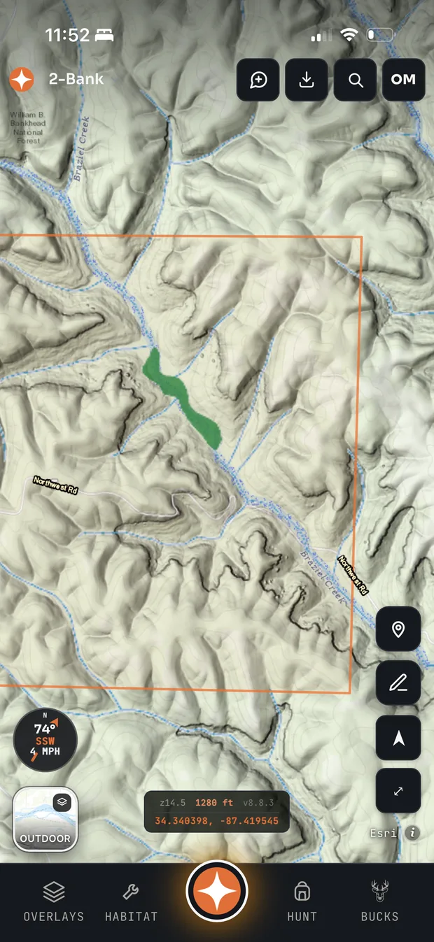
It is included from Pro, in all 50 states.
Parcels and landowner data
Property boundaries come from county assessor records delivered nationwide through Regrid: 160 million parcels across 3,229 counties — every county in the United States, all 50 states, covering 99% of Americans. Every one carries precise boundary geometry, and counties are refreshed at least annually.
Boundary lines are visible on the free plan; tapping a parcel for the owner’s name and mailing address is a paid feature, in all 50 states on both paid plans.
That is the practical difference on a lease hunt: knowing whose gate you are looking at, and who to call about permission on the neighbouring block.
Where every layer comes from
No mystery tiles — each layer names its source:
- Satellite: Google, Esri, and USDA NAIP
- Topo: USGS Topo and Esri Outdoor
- Lidar shading: USGS 3DEP elevation, rendered as hillshade
- Parcels and owners: county assessor records via Regrid (LOVELAND Technologies)
- Public lands: USGS PAD-US, the national inventory of public parks, WMAs, forests and refuges
- Crops and food sources: USDA Cropland Data Layer
- Weather: the National Weather Service where it covers your ground, with Open-Meteo model data behind it
Common questions
How many satellite basemaps does Contors have?
Three: Google satellite, Esri satellite, and USDA NAIP aerial imagery. It also has two topo basemaps, USGS Topo and Esri Outdoor, plus contour lines.
Can you put lidar over satellite imagery in Contors?
Yes. Lidar shading is a layer rather than a basemap, so it can be laid over any basemap including both satellite sources. It is included from the Pro plan, in all 50 states.
Does Contors show landowner names?
Yes. Parcel boundaries come from county assessor records via Regrid, covering all 50 states, and on the paid plans tapping a parcel shows the owner name and mailing address. Boundary lines alone are visible on the free plan.
Do I need a paid plan to get a usable map?
No. The free plan includes USDA NAIP aerial imagery, the USGS topo basemap, contour lines, parcel boundary lines, all your pins and stands, and the wind, scent and weather tools.
Related: all features · how to read topo maps · satellite vs topo · parcel maps