One Map That Knows Your Ground
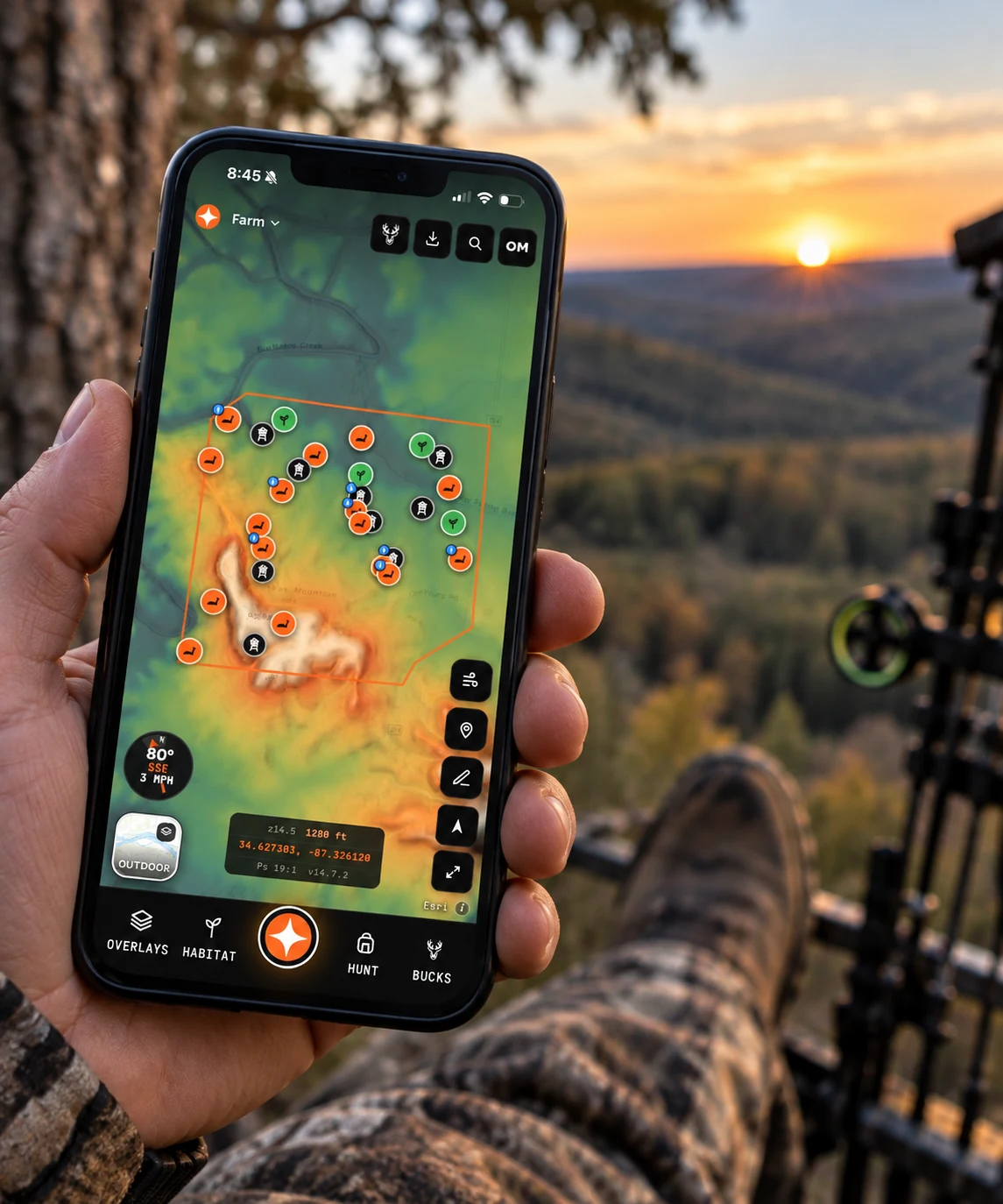
One button opens the wind field and your scent plume over a real property. Everything else on that screen is a feature.


No card. Map one property, drop your stands, and run the wind on it today.
Scout reads your map, then answers
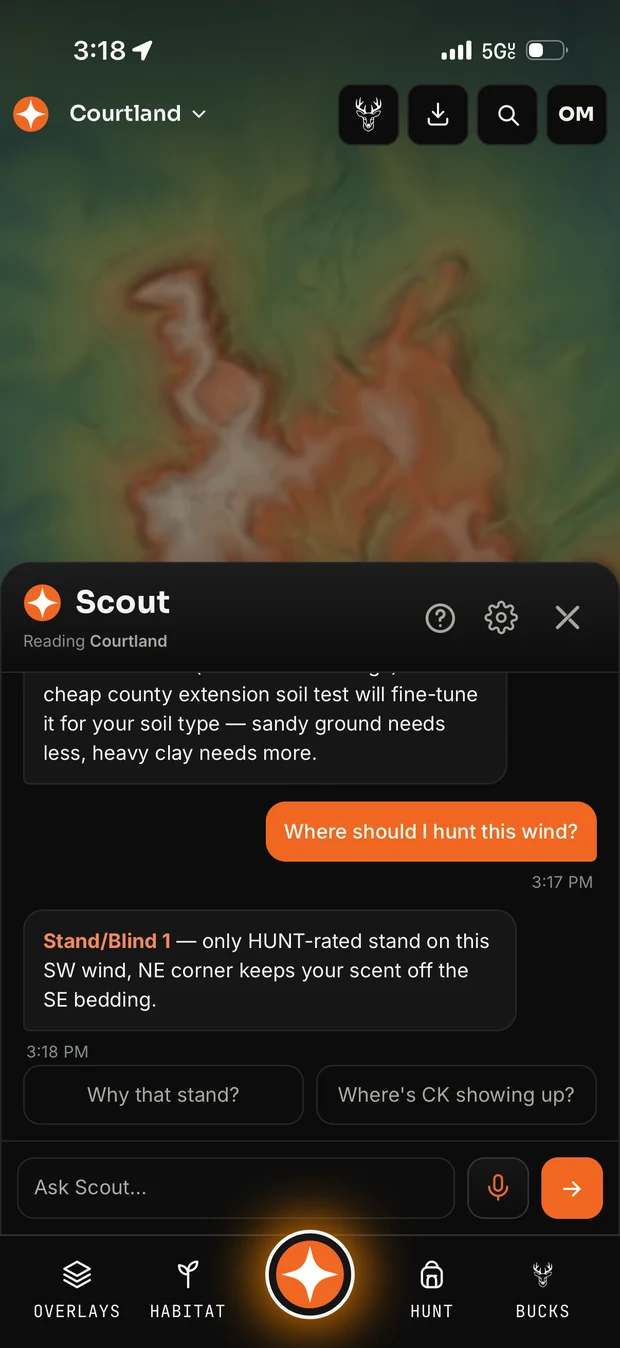
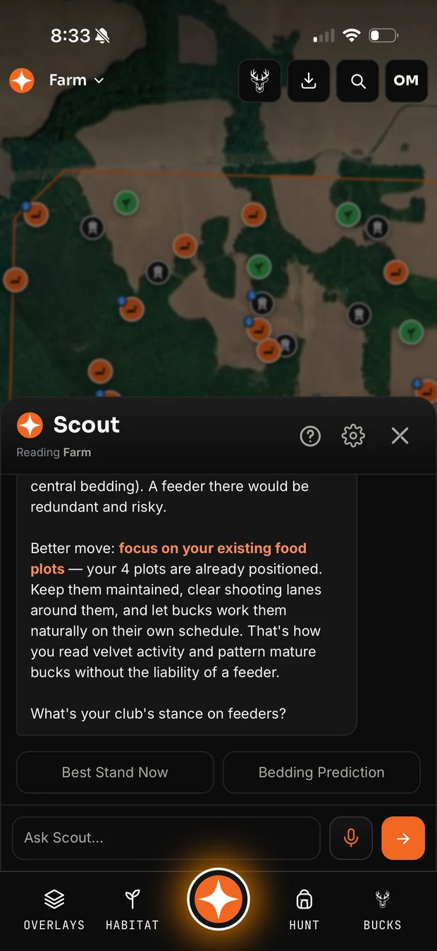
An AI assistant that knows your stands, your sightings, your terrain and today’s wind — and can run the app for you.
Ask “where should I hunt this wind?” and it answers with one of your stands by name and the reason — “only HUNT-rated stand on this SW wind, NE corner keeps your scent off the SE bedding.” Ask what you saw the last three sits at the creek stand and it reads your own journal back.
It is not a chat window bolted onto a map. Scout can turn layers on, drop a stand, draw a route, log a sighting, rank your stands for a date and hour, read the terrain and switch properties — while you talk to it.
And it says so when it does not know. When there is not enough mapped yet, that is the answer you get, along with which part is missing.
More on Scout AI →See where your scent actually goes
Contors solves the forecast wind over the terrain of your property, then draws a plume that follows the real airflow.
Not a cone drawn at wind-plus-180. The plume bends into draws, runs ridges and spreads where the air is unsettled — from every stand at once, from your own position while you walk in, and along the track you are recording.
In hill country the thermal beats the prevailing wind at dawn and dusk. Contors classifies the air as wind-driven, thermal or mixed, and follows whichever is actually in charge at that hour.
Where the air is barely moving it shows scent creeping and spreading instead of running — the most dangerous state to sit in, and the one a compass rose cannot warn you about.
The second screen is the same wind with the imagery stripped away, running over nothing but the bare LiDAR of the property — which is where you can actually watch it bend around the ridges.
More on wind, scent & thermals →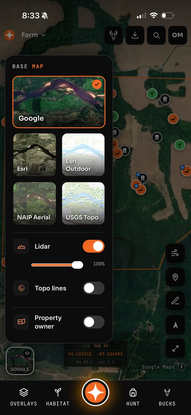
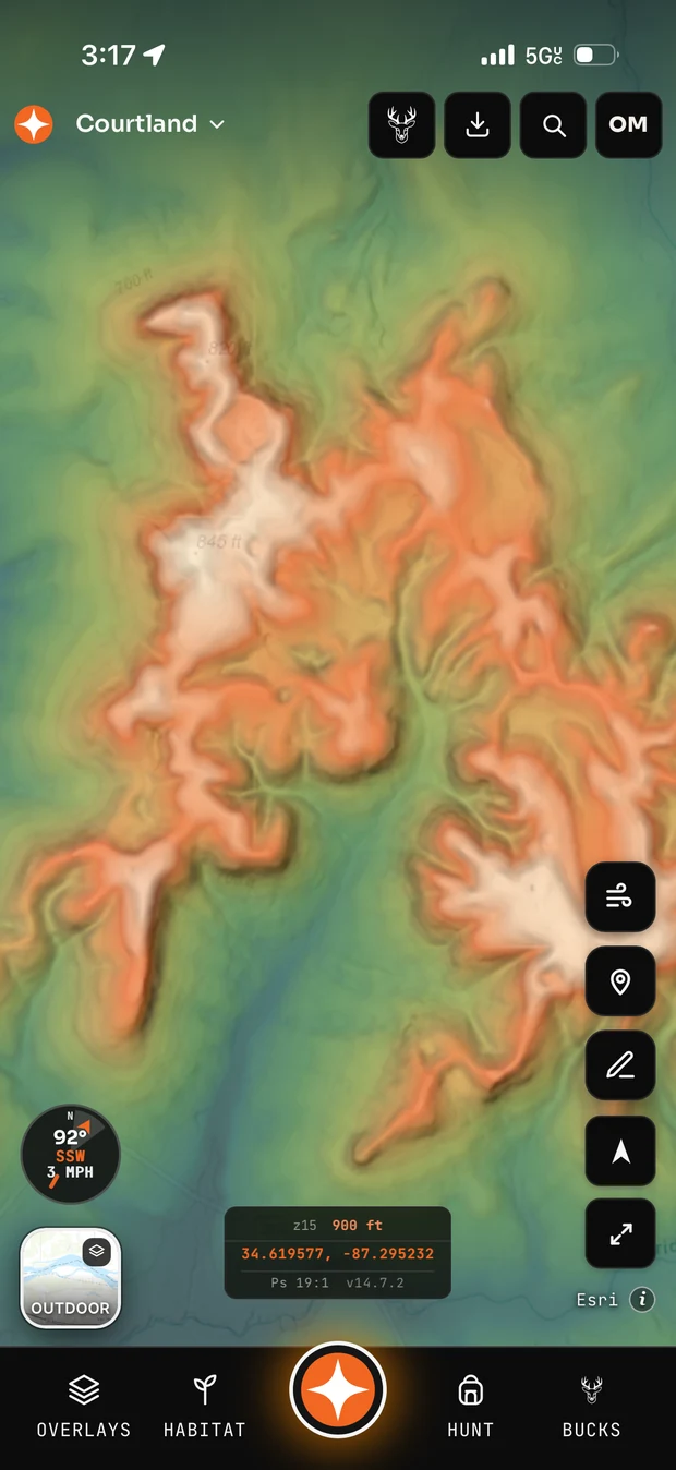
Three satellites, two topos, lidar over any of them
Most apps give you one satellite layer and lock lidar to the topo. Contors gives you five basemaps and lets bare-earth relief sit over whichever you like.
- Google satellite — the sharpest look at your cover
- Esri satellite — a second source, often a different season
- NAIP aerial and USGS Topo — both free on every plan
- Esri Outdoor — a cleaner modern topo
- LiDAR shading at any opacity, over any of them
- Contour lines and parcel owners on their own toggles
USGS 3DEP lidar shows the shape of the ground under the canopy — benches, saddles, ditches, old roadbeds and the subtle points bucks actually walk.
Terrain Heat colours the whole property by elevation, so a ridge system reads at a glance: where the high ground runs, where it drops into the creek, and which benches connect.
More on maps & imagery →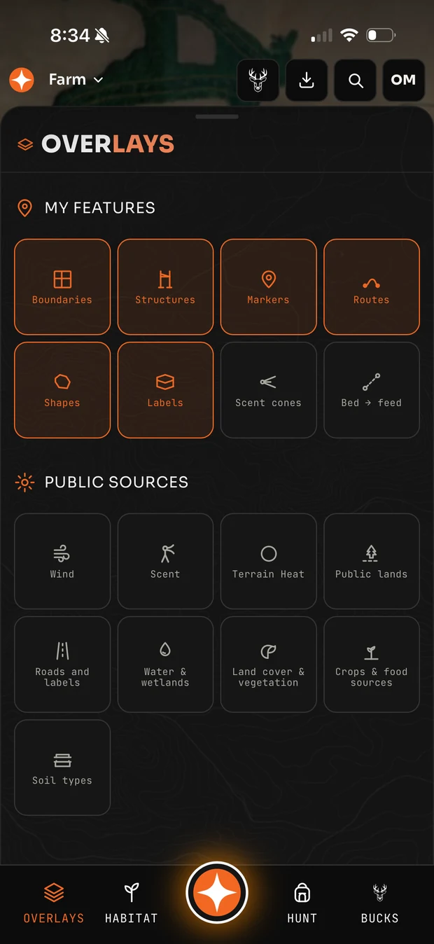
Every layer, one panel
Your own features and public data sources, each on its own switch.
Your features: boundaries, structures, markers, routes, shapes, labels, scent cones and bed-to-feed lines.
Public sources: wind, scent, terrain heat, public lands, roads and labels, water and wetlands, land cover and vegetation, crops and food sources, and soil types.
Turn on what matters for the question you are asking and leave the rest off. Or just tell Scout which layer you want.
See all features →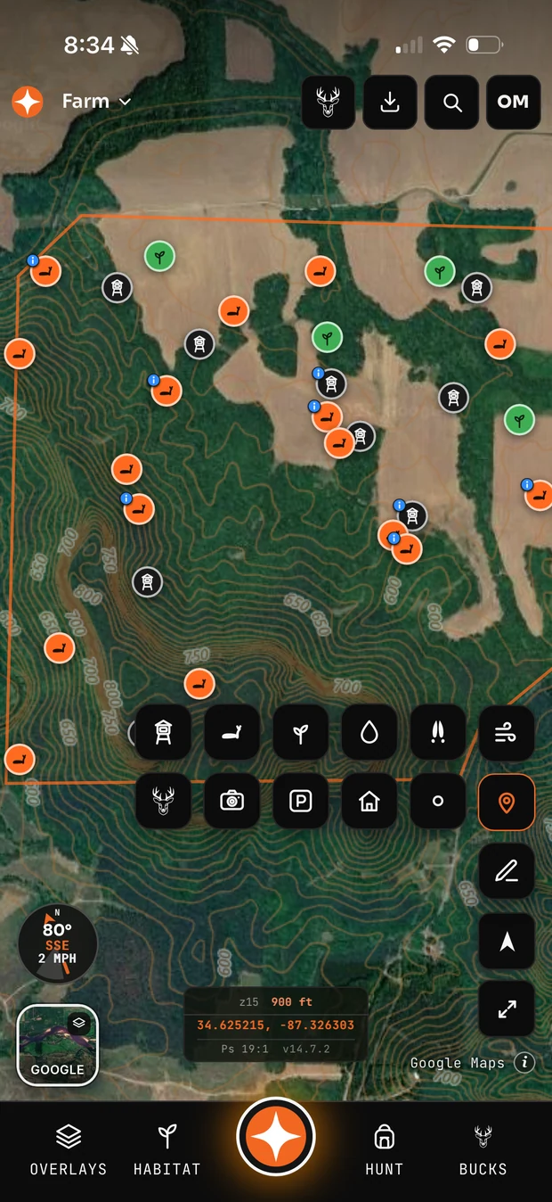
Map your ground once
Drop a stand in two taps, name it later, and find it again by name.
The marker types are the ones hunters actually use — stand or blind, sighting, food plot, water, sign, buck, camera, parking, structure and more.
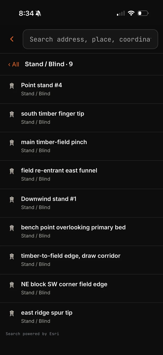
Search accepts an address, coordinates or a place name, and it searches your map too: type a stand name and jump straight to it. The screenshot on the right is a real hit list of nine named stands.
More on the field interface →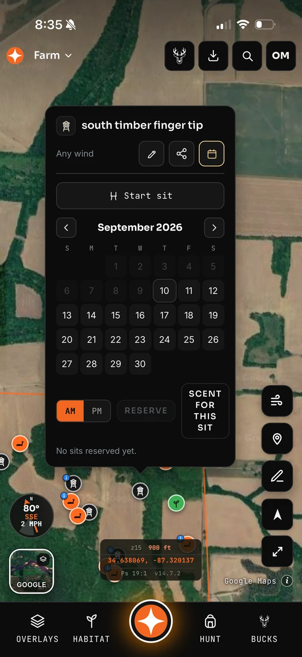
Which stand, which day, which hour
Pick a date and a sit and every stand you own is scored against that hour’s forecast wind.
Reserve a stand for a morning or an evening so nobody in your club doubles up — and run the scent model for that exact sit before you commit to it.
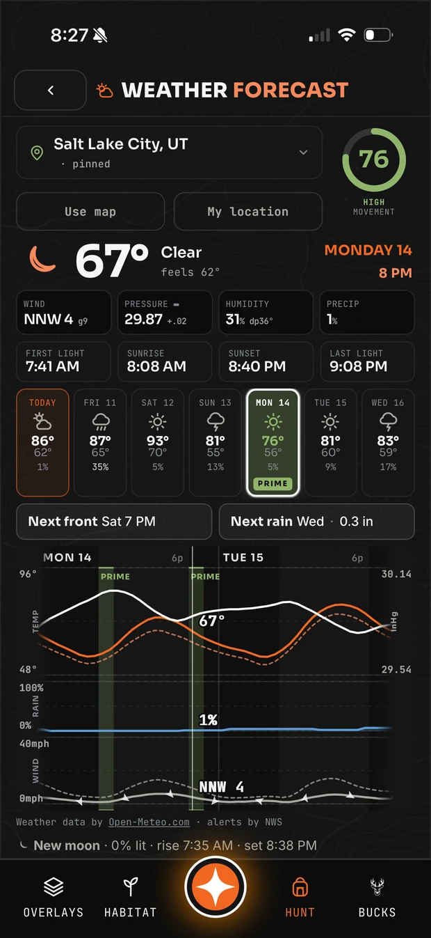
A 16-day forecast built for deer hunters, not for lawn care. Tap the compass chip on the map and you get the whole thing:
- A movement rating out of 100 for each day, with the strong days flagged PRIME
- Prime windows inside the day marked on the hourly chart, so you know which hours are worth sitting
- Pressure and its trend, plus when the next front arrives and when the next rain lands
- First light, sunrise, sunset and last light — and legal light, with the reminder that it varies by state
- Wind direction and gusts, temperature and feels-like, humidity, dew point, cloud and precipitation
- Moon phase, percentage lit, and moonrise and moonset
- Hourly curves for temperature, pressure, rain and wind across two days at a time
Pin any location or use the map, and it forecasts that ground rather than the nearest town.
Every hunt you log stamps itself with the conditions, so the second season is better than the first.
More on hunt planning →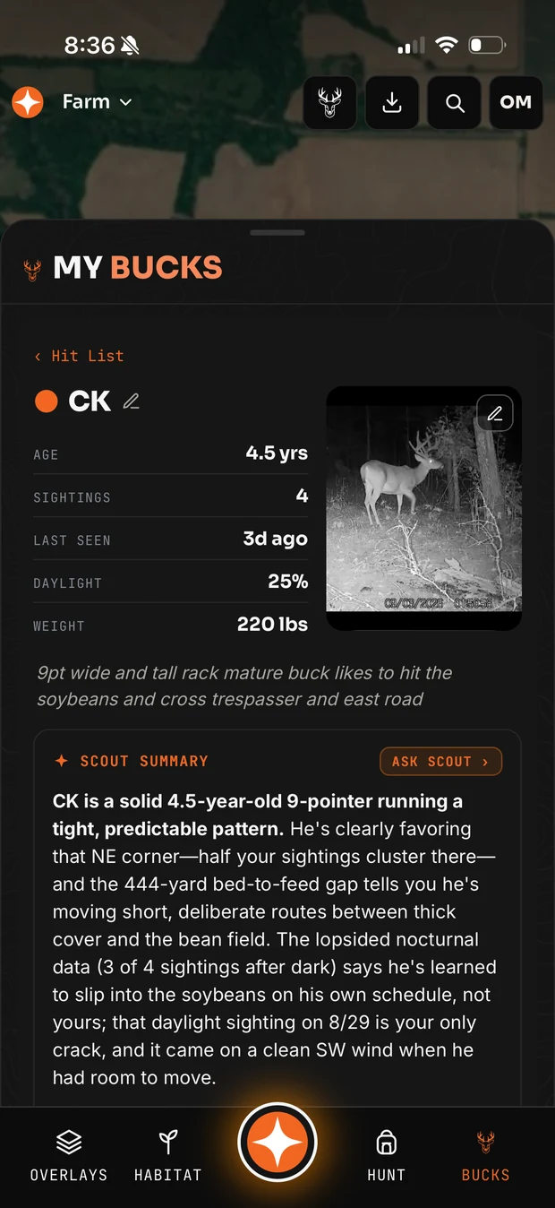
Every buck you are after, on the map
Target-buck profiles, sightings pinned where they happened, and a Scout summary that reads the pattern.
Your hit list carries age, sightings, last seen, daylight percentage and weight. Scout reads the sightings and tells you what they mean — which corner he favours, how far he moves bed-to-feed, and which wind gave you your only daylight crack at him.
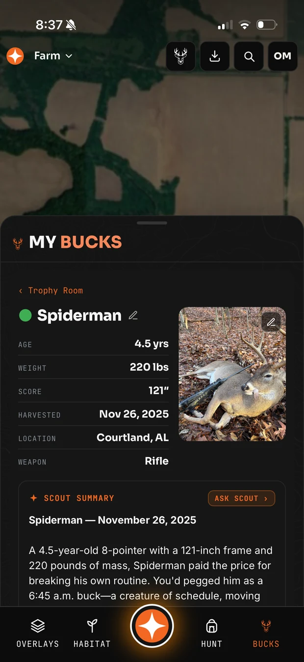
Harvested bucks move to the Trophy Room with age, weight, score, date, location and weapon, and their own written summary of the season.
Buck Score estimates age and gross score from a photo, with the reasoning shown rather than a bare number.
More on buck intelligence →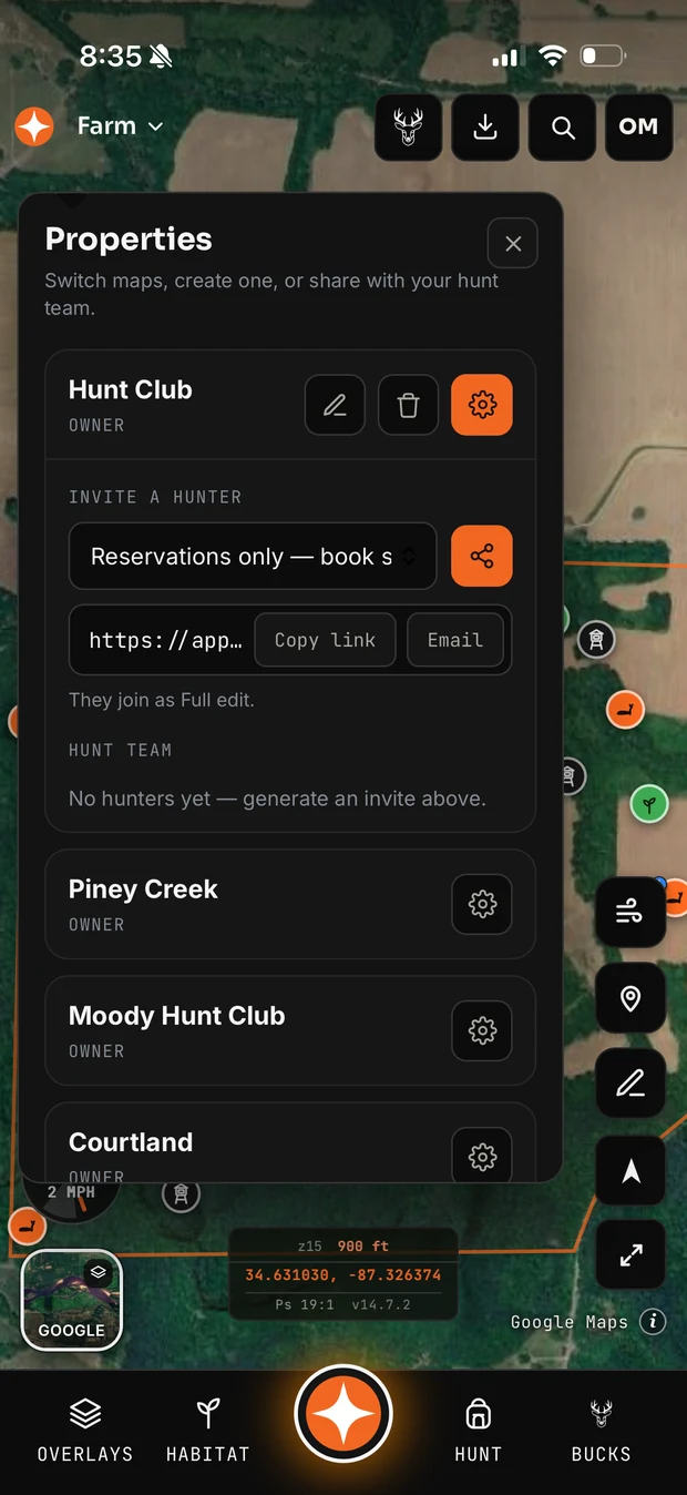
One property map for the whole club
The owner invites the club; everyone works from the same stands, cameras, routes and markers.
Each member gets a role — owner, admin or member — and a permission level. Give someone full access to the map, or reservations only so they can book a stand without redrawing your property.
Stand reservations are visible to the whole group, and Scout will not send a member to a stand somebody else has booked.
Live location is off until you switch it on: you pick who sees you, it updates as you move, it expires automatically at midnight, and you can stop it instantly.
More on hunt club sharing →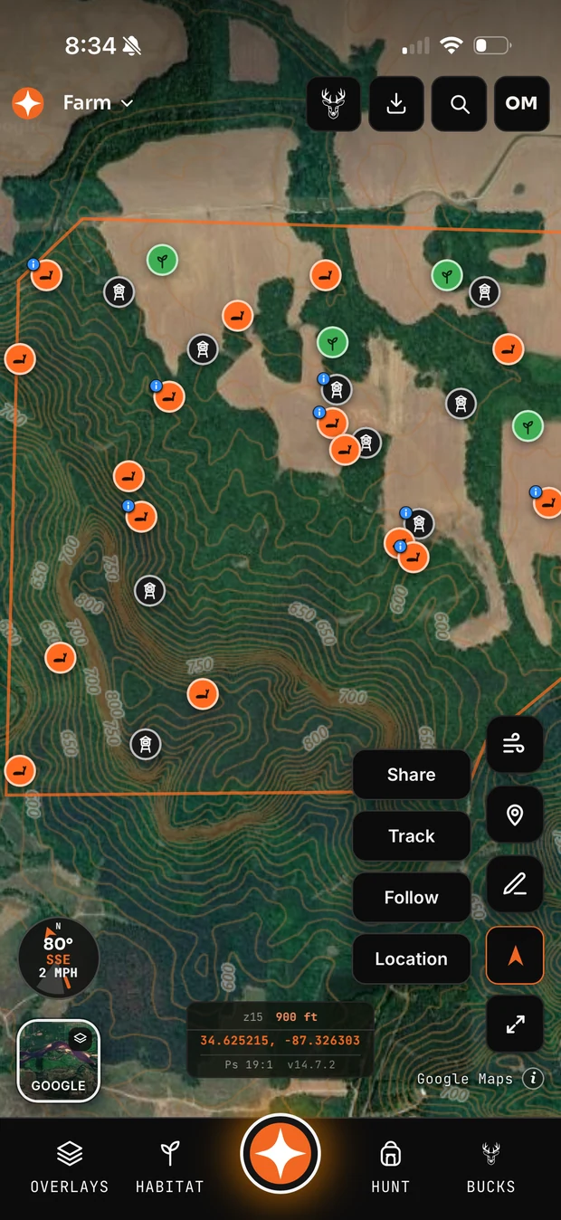
Built to be used in the dark
Compass, GPS, tracks, sharing and navigation, one tap from the map.
Record a track walking in or trailing a deer. Follow your position, share it with your club, navigate back to the truck. Measure a distance or an area straight off the map.
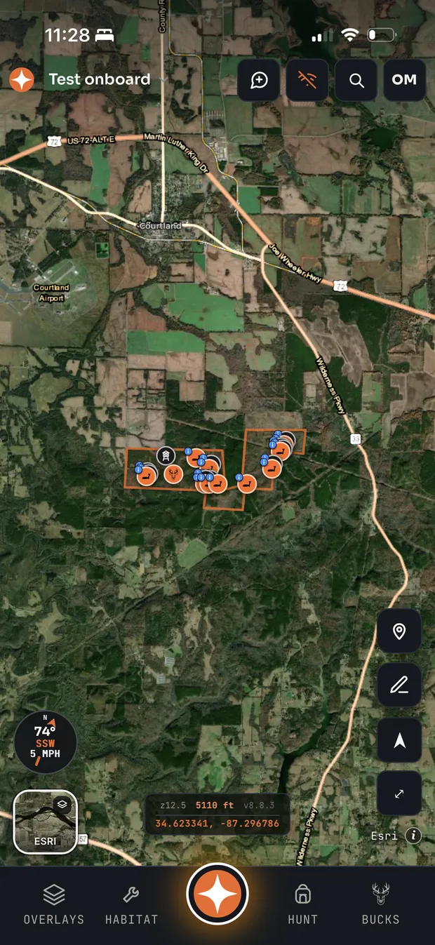
Save your ground for offline and the imagery, your boundary, your pins, the compass and track recording all keep working with no signal at all — then sync when you are back in service.
More on the field interface →Two screens built for the truck and the stand
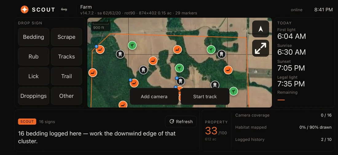
Turn the phone sideways and Contors becomes a dashboard. Everything you need in one glance, nothing you have to hunt for with cold hands.
Scout Mode — when you’re working the ground
Drop bedding, a scrape, a rub, tracks, a lick or a trail in one tap. Add a camera or start a track without leaving the screen. Beside it: today’s light, your property score out of 100, camera coverage, how much habitat you’ve mapped, and Scout reading your sign back to you — “16 bedding logged here — work the downwind edge of that cluster.”
Hunt Mode — when you’re sitting
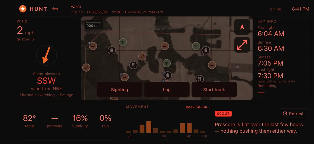
Goes red for the dark so it never costs you your night vision. Wind speed, gusts, and where your scent is blowing right now. Temperature, pressure trend, humidity and rain. Movement by hour with the peak called. Legal light with the reminder that it varies by state. Log a sighting or start a track from the same screen.
Every feature, and which plan has it
Free is genuinely usable — aerial and topo maps, your pins, wind, scent and live weather. Paid adds the imagery, the models and the sharing.
| Feature | Free | Pro | Unlimited |
|---|---|---|---|
| Maps & imagery | |||
| Google & Esri satellite | — | ✓ | ✓ |
| USDA NAIP aerial & USGS topo | ✓ | ✓ | ✓ |
| Esri Outdoor topo | ✓ | ✓ | ✓ |
| LiDAR shading over any basemap | — | ✓ | ✓ |
| Terrain Heat elevation shading | — | ✓ | ✓ |
| Contour lines | ✓ | ✓ | ✓ |
| Parcel boundaries | ✓ | ✓ | ✓ |
| Landowner names & addresses | — | ✓ | ✓ |
| Public lands, water, crops, soils | ✓ | ✓ | ✓ |
| Offline saved areas | — | 1 | Unlimited |
| Scout AI | |||
| Ask about your own property | A taste | ✓ | ✓ |
| Scout runs the app for you | A taste | ✓ | ✓ |
| Scout summaries on your bucks | A taste | ✓ | ✓ |
| Headroom on the smarter model | — | More | Most |
| Wind, scent & weather | |||
| Live weather & hourly forecast | ✓ | ✓ | ✓ |
| Deer movement rating & prime windows | ✓ | ✓ | ✓ |
| Terrain-aware wind field | ✓ | ✓ | ✓ |
| Scent plume from every stand | ✓ | ✓ | ✓ |
| Thermal modelling | ✓ | ✓ | ✓ |
| Deer intelligence | |||
| Target bucks, hit list & trophy room | ✓ | ✓ | ✓ |
| Sightings pinned with conditions | ✓ | ✓ | ✓ |
| Buck Score (AI age & score) | — | 3 / month | Unlimited |
| Buck Refuge Model | — | ✓ | ✓ |
| Habitat & Terrain Analysis | — | ✓ | ✓ |
| Planning & history | |||
| Stands ranked to a forecast hour | ✓ | ✓ | ✓ |
| Scent modelled for a planned sit | ✓ | ✓ | ✓ |
| Hunt journal with auto conditions | ✓ | ✓ | ✓ |
| Property & sharing | |||
| Properties you can create | 1 | 3 | Unlimited |
| Join a shared property | ✓ | ✓ | ✓ |
| Share a property you own | — | ✓ | ✓ |
| Roles & reservations-only access | — | ✓ | ✓ |
| Stand reservations | — | ✓ | ✓ |
| Live member location | — | ✓ | ✓ |
| In the field | |||
| Hunt Mode & Scout Mode dashboards | ✓ | ✓ | ✓ |
| Red night theme for after dark | ✓ | ✓ | ✓ |
| Property score & coverage tracking | ✓ | ✓ | ✓ |
| Compass, GPS & track recording | ✓ | ✓ | ✓ |
| Distance & area measurement | ✓ | ✓ | ✓ |
| Search address, coords or your own pins | ✓ | ✓ | ✓ |
| iPhone app & web app | ✓ | ✓ | ✓ |
Pro $4.99/month or $39.99/year · Unlimited $9.99/month or $79.99/year · both with a 7-day free trial. Compare plans
Go map your ground
No card. Draw your boundary, drop your stands, and run the wind on them tonight.