In the app
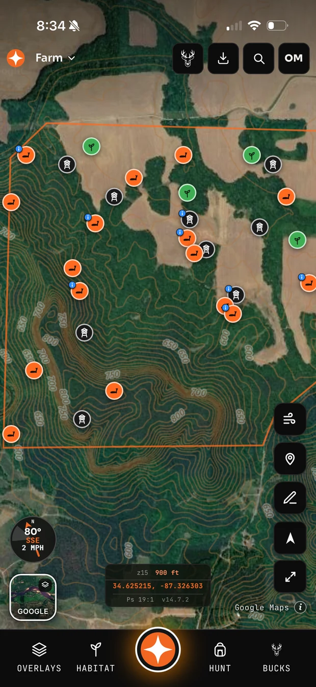
Full USGS topographic coverage of the United States — contour lines, ridges, draws and creeks.
Tight lines = steep; wide gaps = flat. Look for benches (a flat shelf on a slope — one contour line with space around it on a hillside), saddles (an hourglass pinch between two high points — deer cross ridges there), and draws (contour Vs pointing uphill — thermals drain down them at first light).
In the app