Short answer: Terrain analysis is the one part of AI hunting that is genuinely solved. Elevation data is precise, the features that concentrate deer movement have clear mathematical signatures, and a computer finds them across a thousand acres faster than you can across forty.
What elevation data actually is
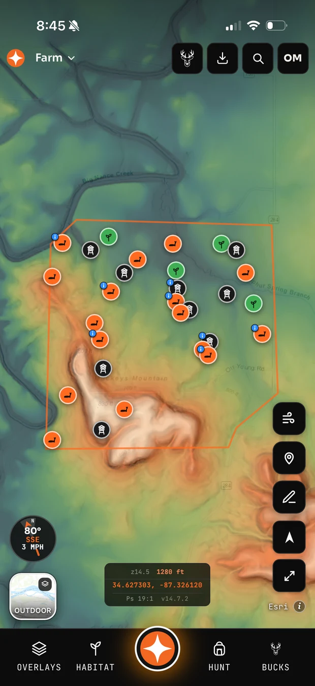
Underneath every topo map is a grid of elevation measurements — in the United States, largely from USGS 3DEP, much of it LiDAR-derived at one to three metre resolution. That is not a picture of the ground. It is a table of heights, and every terrain feature you care about is a pattern in that table.
A saddle is a local minimum along a ridgeline: elevation drops in two opposing directions and rises in the other two. That is a describable shape, and finding every instance of it across a property is straightforward arithmetic once the data is in hand.
The features a computer finds reliably
- Saddles and gaps. The clearest signature of all, and the highest-value one — deer cross ridges at the lowest effort point.
- Benches. A flat shelf on a slope shows as contour lines spreading apart between tight ones. Trivial to detect, and a classic bedding and travel feature.
- Slope and aspect. Which way a hillside faces determines thermal behaviour and where deer bed in cold weather. This is pure arithmetic on the elevation grid.
- Drainages and creek bottoms. Water flow accumulation is a standard computation, and it maps travel corridors well.
- Pinch points from terrain. Where steep ground on both sides squeezes the walkable route into a narrow lane.
What it misses that you would catch
Everything that is not in the elevation grid or the imagery. A blowdown from last spring's storm that now funnels every deer on the ridge. The one gap in an old fence line. Where the neighbour parks. Which oaks actually dropped this year.
Imagery ages too. An aerial from two summers ago will not show the clearcut, and a terrain read on stale imagery can be confidently wrong about cover. This is why terrain analysis is a starting point for boots-on-the-ground scouting, never a substitute.
Using it well
Let the computer generate the candidate list — every saddle, bench and pinch on the property — then walk the top handful with fresh eyes. You are not outsourcing the decision. You are skipping the tedious part where you squint at contour lines for an evening and still miss one.
Common questions
What elevation data do hunting apps use?
In the United States, mostly USGS 3DEP, much of it LiDAR-derived. Resolution varies by region — some areas have one-metre data, others only ten.
Can AI find deer bedding from a map?
It can find the terrain and cover characteristics bedding usually has: thick cover, a wind or thermal advantage, and distance from pressure. Whether deer actually bed there depends on pressure patterns no map records.
Is LiDAR better than regular topo for hunting?
Considerably. LiDAR-derived hillshade reveals benches, old roads, terraces and subtle rises that standard contour intervals smooth away entirely.