Short answer: Most hunters open a mapping app, look at satellite imagery for ten minutes, and never come back. The apps that stick are the ones where you did twenty minutes of setup first — boundary, stands, access — because after that the map is about your property rather than a picture of some trees.
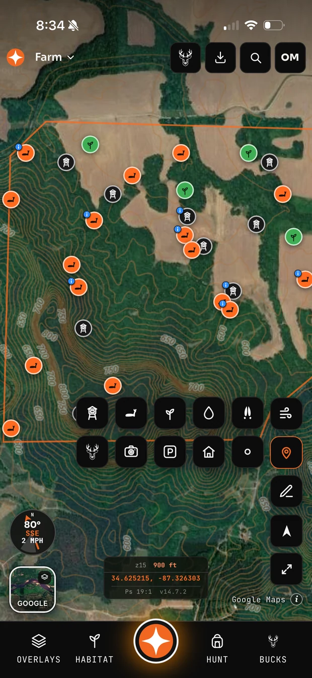
The first twenty minutes
- Draw the boundary. Everything else means less without it. Acreage, distances and whether that funnel is even on your ground all depend on it.
- Drop your existing stands. Including the ones you never hunt. You will learn something from seeing them all at once.
- Mark your access points and parking. Gates, pull-offs, the spot where you actually leave the truck.
- Mark known food. Fields, plots, and the oak flats you already know about.
That is it for setup. Bedding, trails and sign come later and come from walking, not from guessing at a screen.
The beginner mistakes
- Marking everything. A map with four hundred waypoints is unreadable. Mark what you would tell a hunting partner about.
- Trusting the boundary absolutely. Parcel data is licensed and imperfect. Treat the line as approximate near the edges and verify anywhere it matters.
- Only using satellite view. The terrain layers are where the useful information hides.
- Never caching offline. Discover this in the timber with no service and you will not make the mistake twice.
- Not logging sits. A season of logged hunts is the most valuable thing in the app by year two, and it costs thirty seconds a sit.
What to do after the first season
Go back and correct the map. The trail you guessed at was fifty yards north. The bedding you assumed was on the point was actually on the bench below. Nobody does this, and it is the difference between a map that gets better every year and a map that stays a first-day guess forever.
Common questions
What should I mark first on a hunting map?
Your property boundary, then stands, then access and parking. Everything else is more useful once those exist.
Do I need a paid hunting app as a beginner?
No. Free tiers handle boundary, markers and basic layers. Pay when you hit a limit you actually feel.
How accurate are hunting app property lines?
Close enough to plan with, not close enough to argue with. Parcel data comes from county records via commercial providers and error near boundaries is normal.